Flood Protection
Notice of Flood Risk Map Updates
December 2023
The Federal Emergency Management Agency (FEMA) has provided the City of Delta with preliminary (draft) copies of new Flood Insurance Rate Maps (FIRM) and a Flood Insurance Study (FIS) report for review. These documents are preliminary, but if eventually adopted, the new FIRMs and FIS will be the primary documents used to identify flood risk, insurance requirements, and applicable development regulations for properties located within the regulatory floodplain in our community, as required to continue the City of Delta’s participation in the National Flood Insurance Program (NFIP). FEMA is presently giving our community an opportunity to identify and comment on changes or corrections to non-technical information, such as corporate limits, road names, and stream names on the FIRM panels or in the FIS report. Your input is welcome on this non-technical review of the preliminary FIRMs and FIS. For your convenience, digital copies of materials received from FEMA and online interactive maps are linked below along with information on how to access the preliminary/draft documents via the Map Service Center. Hard copies of the materials can also be viewed at City Hall during business hours (8:00am to 4:30pm, Monday through Friday). Printed take-home copies can be provided upon request for a fee. To submit comments directly to FEMA regarding needed changes to any non-technical information on the materials, contact Christine Gaynes with FEMA Region VIII. Comments for this stage of review are due by December 21, 2023. If you have any questions, please do not hesitate to contact City staff.
Send Comments to FEMA:
Christine Gaynes
FEMA Region VIII
Denver Federal Center, Building 710
PO Box 25267
Denver, Colorado 80225-0267
Contact City Staff with Questions:
Community Development Department
970-874-7909
City Hall
360 Main Street
Delta, CO 81416
Links to Additional Information on Map Updates
General Information
- Overview of Current and Preliminary FIRMs (Interactive Online Map) [LINK TO: https://cityofdelta.maps.arcgis.com/apps/mapviewer/index.html?webmap=b077175002254e87bd6f6068ac24c9c8]
- Preliminary Issuance Letter from FEMA (November 21, 2023) [PDF DOWNLOAD LINK TO THIS DOCUMENT: https://drive.google.com/file/d/1aPFBR1az-iPnmIqDpFdDf1h9wbl7A7ID/view?usp=drive_link]
- Preliminary Summary of Map Actions [PDF DOWNLOAD LINK TO THIS DOCUMENT: https://drive.google.com/file/d/1tlUXSz6oHPTo3-qrNxYXNCDp12vT2wxw/view?usp=drive_link]
- Overview of Mapping Changes and Process from Colorado Water Conservation Board (CWCB) [LINK TO: https://coloradohazardmapping.com/story?county=419ccb22-aa70-46e2-9296-ecea65805066]
For Additional Information
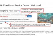
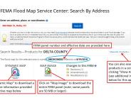
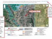
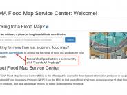
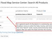
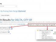
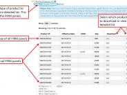
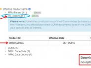
Please consult the PDF document linked at the bottom of this page titled "Updates for 30-Day FIRM-FIS Review" for further instructions. The photos included at the bottom of this page detail step by step instructions for accessing interactive maps on FEMA's webage.

